GPX VIEWER & EDITOR.
A professional offline GPS route viewer, planner, and utility dashboard. Powered by our proprietary local Rush GPS Engine™. No cloud uploads. No account required. 100% air-gapped.
Engineered as a Sovereign Route Utility
Unlike web-based converters that ingest your private coordinate files on external servers, GPX Viewer & Editor operates with absolute sandboxed isolation. Your routes remain where they belong: on your device.
Rush GPS Engine™
Ultra-low latency file parsing inside sandboxed, isolated background execution. Computes complex geodetic distance, ascent, and bounds locally.
Sovereign Route Planner
Draw custom paths, insert waypoints, split trails, and enrich routes with elevation metrics using highly optimized offline geographic interfaces.
Rush Large-File Streamer™
Proprietary secure disk-backed streaming mechanism parses massive expedition logs and multi-day activity files up to 500MB+ without crashes.
On-Device Sandbox Store
Maintains an offline activity catalog, metadata index, saved routes library, and attached photos securely inside local storage limits.
Interactive Local Operations Showcase
Toggle through the Rush GPS Engine™ operations and see them simulate live inside our visual routing console.
1. Rush GPS Engine™
Parses complex GPS tracks completely on-device in microseconds. Instantly computes total distance, climb statistics, and boundary profiles.
Pro-Grade Track Utilities
GPX Viewer & Editor packages professional geographical pipeline tools into an offline geodetic dashboard.
Optimize Point Density
Uses our proprietary Point Simplification Pipeline to intelligently analyze and prune redundant nodes, saving space without distorting track contours.
Divide and Stitch
Slice active expedition records into custom split segments at time/distance boundaries, or stitch adjacent coordinate arrays into a unified continuous loop.
Auto-Repair Markup
Scans XML files on-device to instantly fix corrupt elements, close unclosed tags, restore missing geodetic elevations, or validate structures before maps load.
App Screenshots
A powerful, data-rich interface designed for outdoor professionals.
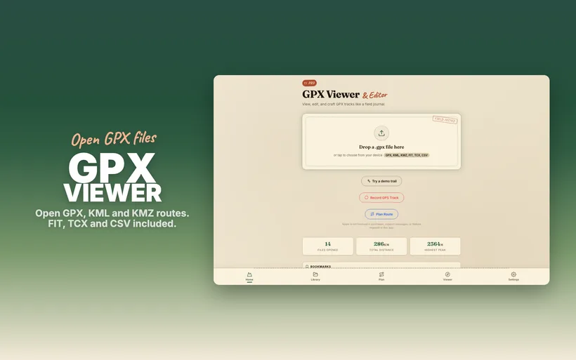
Sovereign GPS Dashboard
Full offline visibility of your expeditions with our proprietary high-performance map engine.
Get the Ultimate Sovereign GPS Suite.
Experience lightning-fast local parsing, multi-colored heatmaps, incline profiling, and clean offline management on your iPhone, iPad, and Mac.